Zion


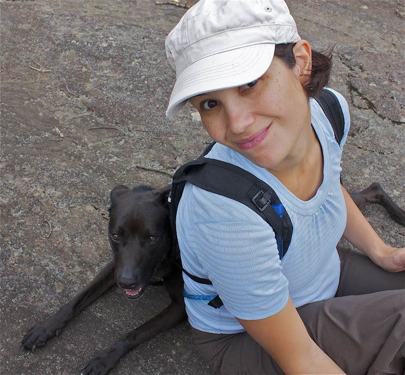
We went to Utah with little idea of where we were going to visit. In the weeks prior to our departure, the concentration was on Moab and Canyonlands (where I went two years ago with Lauren). We needed a trip that could be broken into two sections and one where we might be able to go between alpine and desert. We found all of it in Zion (just south of where we went last year). Matt and I arrived on Tuesday morning and headed to REI to seek out some professional advice on where to head. The store in Sandy, UT was less than helpful. The SLC REI has a desk devoted to public lands and would be your best bet for information.

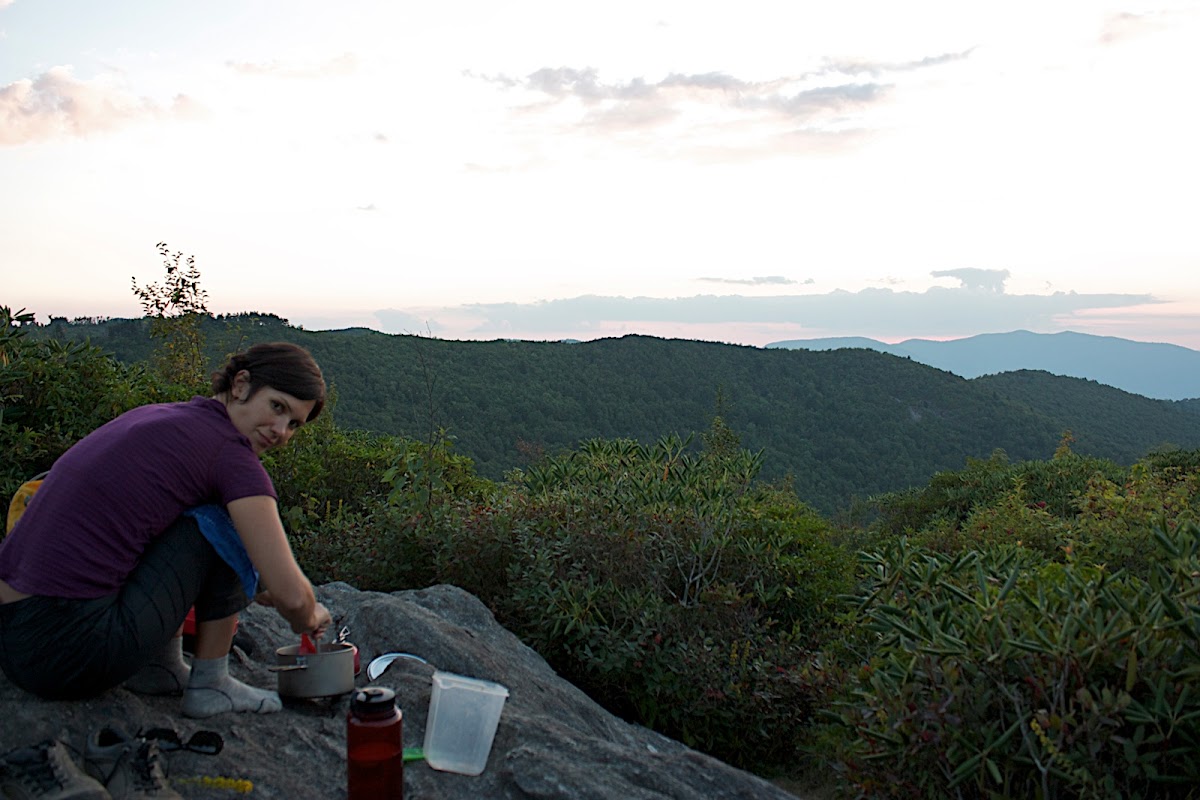
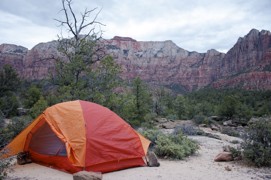
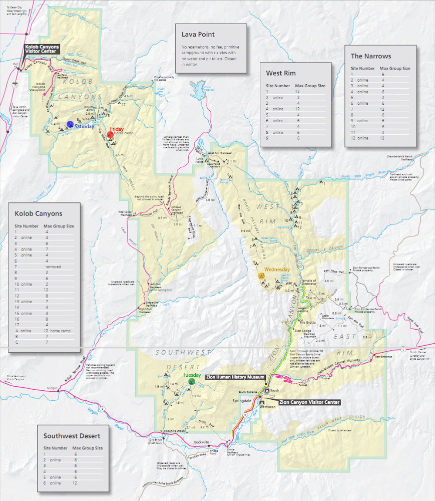
Matt and I headed south in our rental car with hopes of getting some backcountry permits once we arrived at the Park. We ended up getting two nights, #2 in the Southwest Desert section outside the main entrance and #5 on the West Rim for Wednesday night. For the first night we drove out of the park through Springdale and out to the bridge over Coal Pits Wash. You can enter there and hike in the the SW Desert sites. We had a hard time finding the site and tried to use the canyons to guide us after we lost the trail. We did manage to spot two foxes along the cliff walls.

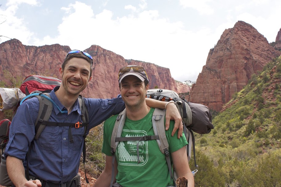
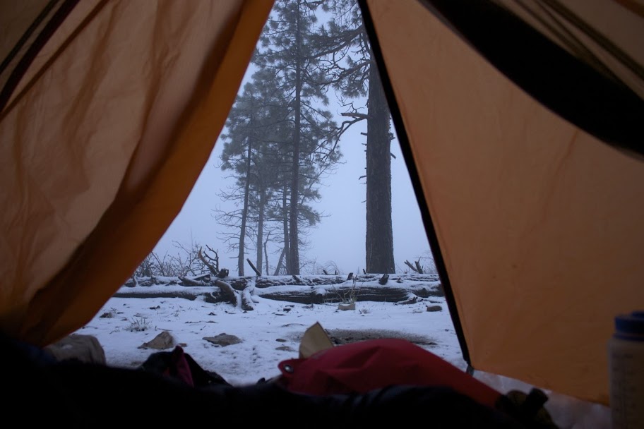
Wednesday morning we hiked out and back to the car. From there we headed back into the park and took the shuttle to The Grotto Trailhead. There we climbed the paved trail up to the split for Angel’s Landing and the West Rim. We continued toward the rim in the rain. Stopping under a ledge to make a hot lunch. The hike up the rim follows steep switchbacks on and next to huge stone walls where we started to see snow. Once on the West Rim we were trudging through mud and struggling to see past fog only to set up our tent while the snow began to fall. We spent the rest of the night in the tent, teaching Matt to play Euchre and listening to Bill Maher podcasts.

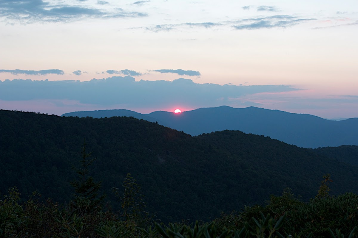
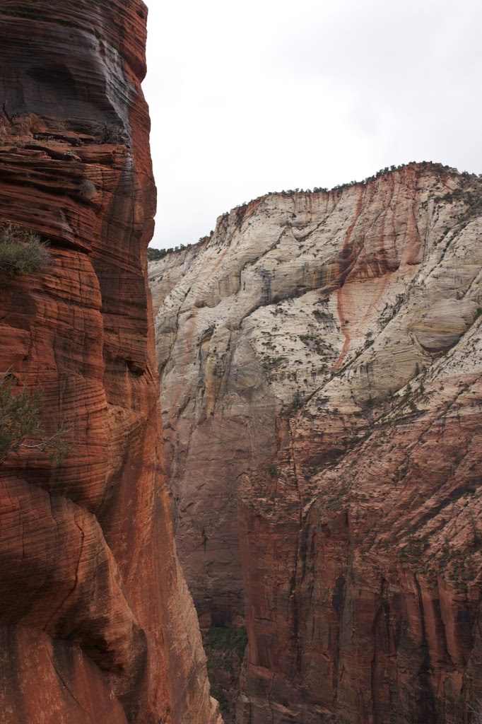
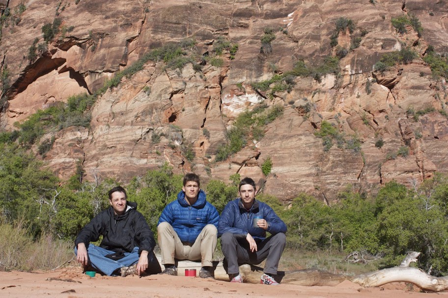
On our way down in the morning the weather cleared and we decided to make a go for Angel’s Landing. The view from the top was great as the sun was just breaking through the clouds in the south valley. As we headed back to the car on the shuttle we started to see the rain return. We used the rest of the day to knock out the Emerald Pool and Hidden Canyon hikes. By the end we were soaked, and headed to Cedar City to meet up with Dave who was driving down from SLC. We grabbed some Mexican food and a room at a cheap motel. In the morning we started to head up to the trailhead for our next two nights on the Virgin River Rim Trail. AS we started the climb out of Cedar City we soon realized that it was too cold and there was too much snow for us to make a go at the trail. We headed back to the Grind in Cedar City for some coffee and ideas for hikes.

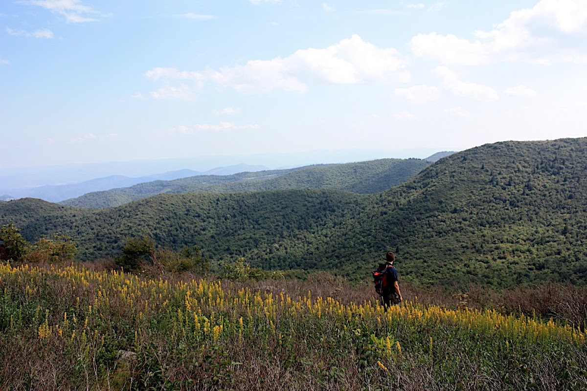
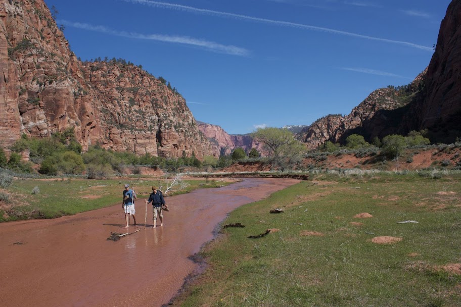
We decided to head to the Kolob (K’lob) Canyon section in the northern part of Zion. We were able to get a horse camp site (A) for Friday night and site #6 on the way back to the car on Saturday night. The horse camp on Friday turned out to be one of our favorite sites. It is in Hop Valley, just after a turn off of the main trail and a river crossing. We had a ton of space at the site and we could explore in either direction down the riverbed that bordered the site. On Friday night we found a great perch to hang out on, and on Saturday morning we walked further up the valley. Those attempting the trans-Zion hike could continue through Hop Valley onto Wildcat and eventually to the West Rim and Angel’s Landing. While we took our stroll in the river up the valley, the weather finally broke. Up until this point Zion had felt like the Pacific NW, but on Saturday the skies were clear and bright blue. I think this spot was one our favorites on the trip.

To get to Campsite #6 in Kolob Canyon we had to cross the river once again and thought we had less space we had a lot of privacy. We spotted a small deer on the other side of the river as the sun set. The next day we headed back to SLC and spent a few nights with Liza and Ella. Seeing them was a great cap to the trip.


Throughout this trip my knees kept bothering me. Then for about an hour one day I was convinced that I was gonna snap my achilles. I was feeling older and vulnerable like I could have a physical injury out there that would delay, hold up, or make more challenges for the whole group. I also felt distracted. Perhaps because of the pregnant wife I left at home, or the work I could have done before I left home. It’s a terrible irony that it takes about 4 days in the wilderness before you can even begin to notice it. There’s a line in City Slickers where Curly snaps at the NYC execs who think they can come out to the range for two weeks and recharge their souls. I think of that sometimes when I get away from the city and how to create that distance more often, both physically and mentally.

Blood Mountain


This Saturday we went north into the Blood Mountain Wilderness to climb to the top of Georgia’s 4th highest peak by the same name. It was our second time there but the first trip in a few years. We found a 5.5 mi loop hike that climbs just over 2000 ft from a parking lot just past a popular destination on the Appalachian Trail: Neels Gap. It’s a beautiful, windy drive up to the trailhead and a pretty scenic hike with great views from the top. There are actually three trails you take to complete the loop. It begins on the Byron Reece Trail and then splits so that you can take the AT up for a steep ascent or take the left fork and stay on the Freeman Trial until you meet back up with the AT on the backside. Then you can hike the AT up and over Blood Mountain back to Reece and the parking lot. This is what we did. It was a good option for a pregnant woman out in the nearly 80 degree heat. The top of the mountain has plenty of spots to sit and relax, eat lunch, and take in unobstructed views. There’s also a shelter at the top for thru-hikers. One fun thing to do if you’re hiking toward Neels Gap is to ask the people you run into if they just came from Maine. Everyone loves that.

You can find good directions and a description of the hike here.

Endless Summer

Lauren is BACK! After three long months, she has returned from the Phiippines and has been finding her way back into American Life. Over this long Labor Day Weekend I whisked her away to North Carolina for some solitude (with me), rest, and romance as we celebrated our 4th anniversary and her return before she heads back to work tomorrow.

First, we headed out to the Shining Rock Wilderness. This hike and camping site, just off the Blue Ridge Parkway near Graveyard Fields, came highly recommended to us by Ben and Katy. We followed Ben’s excellent directions to a secluded hilltop site at around 6,000 ft. The best thing about this place are the views. You follow ridge lines and can see for miles in all directions thanks to previous fires that ran through the region. The other great thing about the place is the abundance of wild blueberries. We were late in the season but still managed to find a few spots with enough berries to have a harvest. The weather varied but all-in-all was great. Very still, clear, and nearly perfect the first night – cooling off and getting a bit windy up on the knobs for the second night and our last morning. The hike out really felt like fall and it was great to be back in western NC to experience it.

We hiked out on Saturday morning and took the Blue Ridge Parkway into Asheville where we had two nights at Louisa’s Porch, a home-stay place in the historic Montford neighborhood. Before we could even check in we had to head over to the Asheville Yoga Center for a class we had booked. It was a class for partnered yoga and Thai massage (pictures) that was part of a weekend-long workshop to benefit a local food bank. On Sunday we strolled around town, sampled a few local brews and stumbled on to the Lexington Avenue Arts and Fun Festival. It was a fun and colorful event; all of the food booths were the street versions of local restaurants, and many people wore costumes and makeup. There was also a bicycle joust and tricycle races. As always Asheville left us captivated, gorged, looking forward to the next visit.

Day 7 – Crawl to the Finish

Log Jam Creek to Gordon River (5km)

Nothing was on our minds waking up this morning except finishing the hike and finishing it with everyone in one piece. We got up early, packed up camp faster than we’d ever done before and were on our way. We spoke the night before about sticking together and seeing this thing through. So it was that Rob would take the lead and set the pace.

Not too much happened on this day except that we finished. At some point in the trail you realize that everyone you pass is fresh, clean and just off the boat. Also, you can hear the ferry buzzing people to the trailhead and you begin to get excited (read impatient). At one such place in the trail we were all standing behind Rob as he calculated how to scale a fallen tree. A section of the tree had been cut out to make a step and it was about 3 feet (~1m) off the ground. He had resisted help and kept his wrists securely wrangled to his poles for 7 (or 8) days, but at this point, with a palpable urgency of 5 guys behind him, it looked as if all that would change. He began to remove his wrists from the poles’ loops and 5 men simultaneously had a common realization and a new sense of hope (like watching a Barack Obama speech). Our spirits were crushed as Rob, instead of taking Matt’s steady shoulder to aid his assent, took his poles, threw them past the opening in the tree and began to climb through on his own.

I have to admit, however, that seeing Rob finish this thing was something I thought about a lot and one of the best parts of the trip. We allowed him to lead all the way to the last kilometer, there we all took a picture with the small yellow sign that said 75km. Then, the magnetism to the finish too great to resist, we all fled for the ferry crossing, leaving Rob in our dust. He showed up a few minutes later with his poles drawn like two six-shooters. He was owed manhugs from us all and he knew they were coming.

Next began a whole other journey in itself. It was so hard to figure out who was going to Victoria General to be with Duke and who was going to head back to Seattle that I can not even remember what we did. I think Rob and Rick went to the hospital and then the four young guys also made a stop to say hi and pick up Rick. Duke was in good spirits and still telling his crushed aspirin story to anyone who would listen. We left him there with Rob while we waited, fasting and sponge-bathed, ready for surgery. He’d wait there prepped for over 24 hours more, and in the same time Rob ran around between the US Canada border like a chicken with his head cut off trying to get his other car up to Victoria (still, no one understands why). We arrived in Seattle and dropped off Rick, sometime around midnight (Thursday night/Friday morning), but determined to get some beer before passing out. Duke would finally make it back to Seattle on Saturday and we went over to visit on Sunday. He was bumped in the queue for surgery 5 times and finally gave up, came back to Seattle and had an appointment with his doctor for Tuesday. He had talked to George who had somehow made his way back to New Mexico since we last saw him.

Skip to the present. This weekend Matt is again out in Seattle with Duke, Rob, Graham and Josh for Graham and Liz’s wedding. Best wishes to all of you guys and I hope to get back out there soon. It was the trip of a lifetime… until the next trip.

http://picasaweb.google.com/s/c/bin/slideshow.swf

Day 6 – Just a Perfect Day

Camper Bay to Logjam Creek (8km)

We woke up happy to notice the morning absent the sound of water hitting our heads. It was not raining, we’d been able to dry some things out the night before and we even got a fire going in the morning to try and dry some more. The discussion about whether to push to the finish or go our own pace continued but now without words. We weren’t going to get the early start that might have allowed us to finish by going our own pace and, in fact, there would still shelter to break down at 8:30. This is what Josh called the work of a subtle saboteur. Regardless, we started the day with a cable car and then headed into the forest for more of the rugged, boggy terrain that we had seen the day before.

I think we were all happy to see that it was noticeably more dry and easier than yesterday. Nonetheless, the up and down over uneven roots and fallen trees made you pay attention to every step. Rob was reliant on his poles and defiant to accept any help with the tougher to negotiate spots. He had taken a few spills on Day 5 but kept pushing along. Day 6 would be more of the same for him. After a few km he, Matt and Duke were hiking at the back of the group. The rest of us stopped at a beach access trail to wait for them but were surprised at how long it was taking. It turned out that Rob had taken a fall that put him in touch with a stump and he now had a gash (about 1″ long; 2.54cm) squarely in the middle of his forehead. Matt had a ziplock full of bloody gauze and tissues to prove it. Minor crisis handled.

We skipped the beach access and pushed on. About 300 meters (or maybe 150 yards) down the path we came to the bridge over 150 yard Creek. Matt and I crossed, commenting on the missing boards and single-sided handrail, and were on the other side when we turned around to See Duke face down on the side of the ravine. Rick worked his pack off, we sat him up on the bridge and eventually we tried to see if he could put some weight on his legs. We knew that he had injured himself and thought it could have been serious (after sitting up he briefly blacked out, likely due to the pain). Standing up was not successful and we prepared to sit him down and call for help.

Our cells phones didn’t work and the VHF radio we had could only receive, not send. Mostly we could either get the weather report or listen to fisherman and leisure boaters talk about old Norwegian-made skiffs. Finally a group of Canadians passed with a cell phone that they graciously let us borrow and we reached the rescue service and made them aware of our situation and position. A helicopter would be deployed.

We set up a mini-camp to get Duke’s leg stabilized and on a thermarest and his body warm and fed. We made some hot water and waited for the rescue team to radio us. I have no recollection of time during this. Finally they called to say the helicopter was leaving and heading to beach access B (see map) about 300 meters, or 8 min of normal hiking, back on the trail. We heard the copter within 3 minutes and Matt and I rushed to meet it.

Two rescue workers exited the plane and recognized our excitement at the novelty of this unfortunate event and they put us to work. Matt carried the stretcher into the site and I helped out with rope bags. Shannon (the female rescue worker with whom Duke had spoken two days prior at a lighthouse encounter) got his leg into a vacuum jacket. James (the other rescuer) set up some ropes near the beach. Like most of the beach access points this one had the trail meeting the beach at a cliff of sorts and this one was luckily short at about 30 feet down a ladder. Since you can’t go down a ladder on a stretcher, James would anchor a rope rig around some trees and we would lower the stretcher over the side of the cliff with a couple of us on the ladder guiding the things down with a free hand.

Once we finally got Duke on the stretcher it took all four of the youngsters along with Shannon and James to navigate and maneuver the thing down to beach access B. I would say this took over an hour. Two locations were ravine crossings formed with fallen trees. We tied a rope to the front of the stretcher and a couple of us would pull Duke along the top of the log while the others would position ourselves next to the log, sometimes into the ditch, and guide him across. Once we reached the cliff there was one more small detail to work out: Duke had to stabilized so that as the stretcher became vertical and went down the cliff he would not put weight on the bad leg. Shannon tied some fancy knots and we figured we had it. To test it we tilted the stretcher up and let Duke relieve himself, his body completely strapped to the stretcher. It was like silence of the lambs, minus the muzzle. At about this time the pilot came up to say that the tide was coming in and that he was going to have to move. James pushed for a few more minutes and we successfully got Duke to the helicopter with minutes to spare.

By now Matt, Graham and I had sent Rick and Rob with Josh to start moving toward the next campsite. It was getting late and we had about 4km to go before we could stop. We decided to try for a small campsite off the trail just south of the path to the Trasher Cove Beach campsite. We knew we couldn’t make it to the Cove (1 km for the actual trail) and we didn’t want to add that 1 km onto the next day either so we were shooting for Log Jam Creek. When we caught up to the crew in front we still had over a km to go and it was nearing 8PM if I recall correctly. We also found out that more blood had been shed, as Rick ran his head into a low clearance fallen log. Scalp wounds are known to produce a deceiving amount of blood (I should know), but Dr. Rob patched it up with superglue. We finally pulled into to our site sometime after 9 and quickly set everything up, got water, made dinner and hung the food. Our three tents barely fit in the space. If someone else had already set up shop there we would have been out of luck. We were so close that there was really very little on everyone’s minds except for where Duke was and finishing the trail. We had just finished a day where four of us managed not to get hurt.

http://picasaweb.google.com/s/c/bin/slideshow.swf

Day 5 – Rain Forest

Walbran Creek to Camper Creek (9km)

I better get this story down before I forget the dirty details. On day 4 I noted the sound of the rain on the tent as we fell asleep. Well, it was still raining in the morning and on Day 5 we had finally arrived in the Pacific Northwest. The rain had moved in and sat on us for the entire day. We set up camp in an efficient manner and started toward our next destination: our full day of travel in the forest (no beach).

Before anyone can go on the West Coast Trail they have to go through an orientation. In it they tell you about the animals, the campsite amenities, the ladders, the cable cars, and they walk you through the whole trail. Here they tell you about which sites might be closed, and where water can be found. We did the orientation at Port Renfrew so they walked us through the route from south to north. They always mention that the south portion is the easy part and if you are heading north once you hit Walbran you’ve finished the first (difficult) section and you have only 53 km left (easy). You’ll notice that on Day 5 we started at Walbran Creek (kilometer 53).

We trudged through Day 5. I remember being in good spirits despite being soaked. I also recall huge sections of ladders and a long bridge at Logan Creek. With about one or two kilometers left, Josh and I went ahead to find a spot at Camper Bay and hopefully to get a fire started. We arrived to find one of the smallest sites we’d seen on the trip and certainly the one with the smallest amount of firewood and none of it dry. Surprisingly, the site does have two food lockers and two toilets.

Despite the lack of dry wood we were lucky to be the second group to arrive that day and we began to salvage any wood that looked like it might burn and try to get a fire underway. Some native Vancouver Island guys made up the group that beat us to the site and had already claimed the good wood. They also had a tarp up and had a fire going. The rest of our group arrived shortly and soon we were all freezing. Priorities included getting the tent up and changing clothes. About an hour after I arrived we still had very little flame going and I got in my sleeping bag and took a nap. Feeling lazy and hearing everyone else still outside and moving around I got up a bit later and found that our fire was under way. Rob, who was without a change of clothes and flush with solid fuel for a stove we would never use, had been working on it and finally got it going. We could not have done it without him and an awkward German/Japanese guy who came over to our camp and sawed some wood. Thanks guys.

Eventually the rain subsided after what I estimate to be about 21-22 hours. We somehow had the most kickass fire in the whole bay. By now travelers were rolling in along with stories about the route ahead and how tough it would be from here to the finish. Some arrived after nine hours of wet hiking all the way from Port Refrew but all of them looked at our fire with envy as we dried our clothes. Some people even came over to use it on their own clothes. In the morning it was more of the same, we got the firs going and dried some more before setting off. It wasn’t the sunny weather we had enjoyed earlier in the trip but we had weathered the worst of the storm. After such a trying day there was some argument about how far to go on the next day. Some thought we could push all the way to the finish, but we would have to get an early start and reach the Gordon river crossing before 4:00 to catch the ferry. Others resisted the pressure and insisted we not push it and see where we are as the day progressed. Neither of those happened.

http://picasaweb.google.com/s/c/bin/slideshow.swf

Day 4 – Monkey Farts

Cribbs Creek to Walbran Creek (12km)

Coming off the high of Day 3, and anticipating more great weather we once again opted for an early start. This would get us moving and set up at the next campsite with time to relax and enjoy the evening. Getting to site’s early also ensured that we would get space in the food locker, firewood – though this was hardly ever in short supply – and a good campsite.

Once packed up at Cribbs our day went pretty much as expected. The early morning mist burned off just as we came to Chez Monique’s. This is the very famous ‘restaurant’ set on First Nation land along the trail. Crab omelets and burgers were available for $20 as well as soda, beer and an assortment of candy. They even had bottles of wine for purchase. The whole situation is a little weird with huge piles of trash behind and next to the kitchen area. For the first time in days we saw pieces of the civilization they had tried to escape briefly and it was a bit ugly, albeit delicious. At the same time I think I romanticize it all more than others. Sitting around the table the group engaged in some vigorous debate and complaining about kids these days. A woman, perhaps Monique herself, chimed in and imparted a bit of wisdom about how giving makes one rich, and ironically Rich was the least willing to accept this.

The day went on in sunny, gorgeous fashion that was all beginning to seem pedestrian (pun intended) to us. When we arrived at at Walbran I laid down next to the fire ring and took a nap in a bbq pit, as Matt so appropriately described it. Our final custom-made-Duke-dinner was prepared: re-fried beans and rice with cheese in soft wheat tortillas. There was also more bacon from the huge Costco bag, which miraculously was finished on its second day. Duke suggested that we also go ahead and make the field tiramisu that we had prepared for Matt’s birthday (still 2 days away). We all agreed that it was a good night for it and it would make the packs lighter. This line of reasoning is what also led to the early devouring of the biscotti (2/person) on the previous night. Field recipe tiramisu probably sounds risky to impossible but it was awesome. Well done Duke and Graham on all the prepared meals!

The rest of the night was spent creekside skipping rocks, chatting and throwing monkey farts – a trick Matt showed us. You take a rock that might be good for skipping and throw it high up into the air. You want it to hit the water exactly opposite of what you are going for with skipping. The sound you hear is supposed to resemble that of a monkey farting. The rocks here and the still, deep river are perfect for it.

Walbran Creek is the first site where we heard about the mice. Some of the sites are very close to the woods and at night they come out and they will get into things. Matt and I had selected a spot right at the edge of the woods and we heard tons of them scurrying around and squeaking to each other. At one point a mouse came under the fly and onto the tent. To be exact it was on the outside of the tent right over Matt’s head, which because of the design of the tent and the height of Matt meant that Matt could feel it on his head. We are wimps. I’m not sure how we
fell asleep but I remember it starting to rain before I drifted off.

http://picasaweb.google.com/s/c/bin/slideshow.swf

Day 3 – Swimming

Tsusiat Falls to Cribbs Creek (16km)

I woke up this morning nervous about the back of my foot. I had a sharp pain from the way the back of the boot folded and put pressure on my Achilles when I took a step. Also, I had just finished a day that I thought was the worst of the trip so far but I was not about to quit or complain. Of course neither would have done me any good. Richie “Hollow Point” Powell hooked me up with some anti-inflammatory meds and I laced my boots up in their old ‘classic’ way (the same as from the first two days, but I had strayed from this style the on the day before). I felt pretty good as we set off from the falls.

This day’s hike was scheduled to be a long one, since there were limited points at which to obtain water and a camp site in the middle – Cheewhat River – was closed due to bears in the area. It would be our longest of the trip at over 16km. Thus we got an early start and the organic rhythm that began to make itself apparent the night before again appeared, this time a bit more refined still. The early start did us well. We started on the beach and came up to Hole in the Wall within the first hour, a classic spot on the trail.

In addition to the early start the group had vowed to avoid the mistake of the prior day which was to skip lunch so as to reach our final goal even faster. This last goal wasn’t much of a problem because of the ferry crossing at Nitinat Narrows. When we arrived the sun was shining and the sky was blue. On the other side of the crossing there were fresh crab lunches ($20) and beers ($5) to be had by the rich.
Following lunch we continues on in the good weather and after km36 we popped out on a beautiful beach and took some time to admire it. The weather seemed to carry us and the weight of the packs was no longer obvious but more assumed and beginning to feel natural. I think it surprised everyone when we arrived to our destination; I thought we had about 3km to go.

On the far side of Cribbs Creek we found a nice shelter next to a small stream and a wall of rocks. We all went for a dip in the ocean, tried to dry some clothes in the sun, and made the most of this late afternoon glory. Josh and I tried to do some climbing on the rock wall next to the site. For dinner we had what was called the unwrapped baked potato. It was dehydrated mashed potatoes, vegetable medley, pepperoni, cheese, bits of real bacon and butter buds. That’s right we carried with us pepperoni, smokes salmon, and real bacon (a huge Costco bag that was subsequently used for snacking, throwing a pinch in like a chew and with meals that followed) through bear country. It was a bit salty but hardy. We sat on the rocks and watched the sun set. Having accomplished our loftiest goal thusfar and with our spirits lifted by the beauty of the place we were part of, we felt optimistic about the rest of the journey.

http://picasaweb.google.com/s/c/bin/slideshow.swf

Day 2 – On the Trail Again

Darling River to Tsusiat Falls (11km)

We woke up on this morning to find ourselves engulfed in the misty rain that is so characteristic of the region. It creeps in and then just sits there on top of you. The weather does, however, help everyone pack up with increased efficiency. Rob had dazzled us just two days prior with his modular, stripped down pack from eBay. Unfortunately, the ultralight pack, which sat on a hook on a belt, broke before we were 5km into the hike. Today he was once again exhibiting the pinnacle of equipment performance with his rain poncho/pack cover all in one. The concept – like that of the pack – was solid but in practice it presented issues. The elastic cord to cinch up portions of the poncho ended up dragging behind Rob, occasionally getting hooked on roots and branches. Josh, who was Rob’s unofficial guardian on the trip, would have stop Rob once the cord had stretched about 25ft behind him and before it would release and snap back at Rob.

Personally I felt this was the worst/hardest day of the entire hike. The trail was much more rugged than the first section but not as rugged as we would run into later and I had this biting pain in my Achilles from the boot. It made the relatively short day go on forever. Day two did give us our first cable car of the hike. No matter how bad the day is going the sight of some serious mechanical hardware makes you feel like a kid.

Our stopping point for the day was the Tsusiat Falls campsite, perhaps the most picturesque of all the sites along the trail. We got there at a decent hour and had some time to enjoy this idyllic spot. We were sure about the rules regarding bathing in the water since everyone was also using it to obtain their drinking water but we some people go for it. For dinner that night we had hummus, textured vegetable protein (TVP) flavored with Middle Eastern spices, couscous and tomatoes. Also we were beginning to realize that our planned meals were actually much larger than needed for the group. We managed to give our extra hummus and couscous to a young Vancouver Island native to whom we gave the name Lars and whom we saw at several other points along our trip. Despite my feelings about the day’s section of trail our trip was back on track and we were moving closer to our ultimate goal.

http://picasaweb.google.com/s/c/bin/slideshow.swf

Day 1 – "A Whale of a Time"

Pachena Bay Trailhead to Darling River (14km)

What else can you say when the captain of the captain of the whale research vessel you just hitched a ride on asks you to sign his guestbook? (see post title) We started our day at a hotel in Port Renfrew and boarded the vessel sometime just after 6:30. I thought we were just getting a ride to the northern trailhead but it turned out that Brian (captain, my captain) was a whale researcher and halfway up there he got word of some orca and we turned that boat around. We got to see several orca and learned about the different types, how they are identified and how they operate socially – it’s matriarchal with the oldest female (some nearing 100 years old) making all the decisions for the pod. We also saw gray whales (less exciting) and sea lions. Rob offered a kid (maybe 10) who had just finished the trail skittles in exchange for carrying his pack for the old man. From then on out we were calling Rob “Skittles” and thinking of nicknames for everyone else on the trip.

From the town of Bamfield we hopped in a shuttle van to the trailhead, signed some papers and were ready to set off. The first day’s hike went pretty smoothly. We stopped for lunch at Pachena Lighthouse – very near Vulva Mouth Beach on map – , started to lay down a communication routine and began to understand what we were in for. About 12 km in we popped out at Michigan Creek beach camping – a popular spot for the northbounders – and kept on going to Darling River just 2k down the beach. The beach terrain of large rocks and then soft gravel was far different from the dirt and boardwalk of the forest trail we had started on. About 15 minutes into the beach travel we spotted a black bear ahead of us on the beach. We (6) all stopped and waited to see what it would do. It eventually turned and headed into the woods with a seal in its mouth. Half the group (led by Rob) pushed forward after about 2 minutes and even stopped where the bear had been to look around, fix gaiters, etc. Graham, Matt and I waited a bit longer. Eventually we proceeded and once about 100 ft for the spot of the original sighting we noticed a black mass that had re-emerged from the forest. We walked backward, Graham with his poles flying in the air, and sat on the beach for another 15 minutes. Meanwhile a bald eagle flew overhead, someone spotted a whale off the coast and we realized we were in the wilderness.

That night at camp was a little it rough. Everyone was still at the feeling things out phase and everyone had their own routines for camping – dinner, water shelter, etc. – but the group did not have a routine that was held in common yet. The planned meal ended up not happening as we arrived later than expected and instead we got by with readymade dehydrated meals in a bag. The food locker was full before we got ours in and trees to hang from were hard to come by. Our bags were hung just out of human reach and from a tree that was fallen and tilted out over the beach. Also one of our food bags was just a trash bag wrapped in rope like gift for the bears. We were obviously novice but the learning curve is steep. Stay tuned to hear if we turned this ship around (literally).

http://picasaweb.google.com/s/c/bin/slideshow.swf